How to hide geology on Mars

New craters and wind
June 13, 2016
Landslides unlike any on Earth
July 5, 2016
Categories

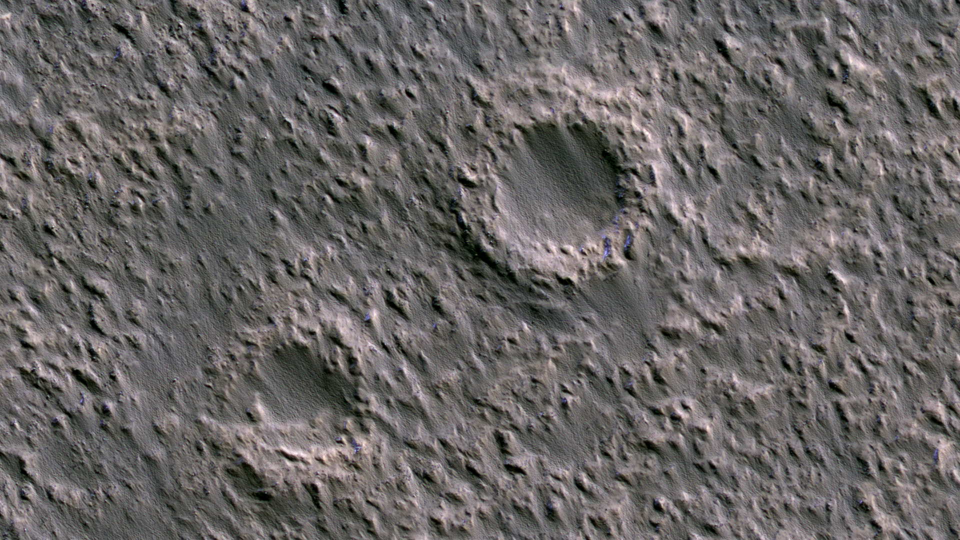
A Piece of Mars: Three things are trying to hide in this 0.96×0.48 km (0.6×0.3 mi) scene. 1) Craters are slowly being both scoured and buried by migrating sand, 2) the sand itself is hiding in the lee of crater rims and other topographic obstructions to the wind, and 3) small patches of ice (blue in this stretch) are hiding on shady slopes (north is to the right in this southern hemisphere image, taken during southern winter). (HiRISE ESP_045792_1395 NASA/JPL/Univ. of Arizona)


1 Comment
Yes, those sure look like giant sand tails pointing down wind from projecting obstacles, giant that is relative to the small ones that I’ve been observing in the rover archives, where we can see that they actually are sand. Its been interesting to look around the Hirise image at full resolution. The stuff that appears to form the giant sand tails is almost everywhere rippled, which supports the conclusion that this is all the same fine grained material. These ripples, like the rippunes on Namib Dune are strikingly invariant in size. I make them to be about 2 m across, maybe a little smaller than those at Namib, described as 3 to 4 m. They are not very straight-linear, rather quite sinuous, but they do have long axes, which are overwhelmingly oriented parallel to the apparent wind direction as indicated by the tails. Here and there small patches are more linear and parallel but the ripples are still about the same width. The ripples in these patches, it seems can be oriented in any direction. In places there are sets oriented at right angles to each other in close proximity and even places where they seem to have overridden forming a cross-hatch pattern.
For 5 years now I’ve paid close attention to sand tails in the rover images. I got a surprise right away when I started. Turns out the best predictor of the direction of a tail is the local slope. If it is on a slope then the tail will sweep generally uphill from it’s rock. Slopes are also more likely to produce tails than flat ground. So its quite easy to find examples of tails pointing in completely different directions in close proximity, often within a single image. I found this out at Fram Crater, which is so small that tails “behind” rocks all around the wall can be seen from one station. They all point up the wall, that is, in all different compass directions. The pancam images from sol 85 (87) are sufficient to confirm this. The same rule apparently applies to Meridiani in general and the other two rover sites as well. Maybe we thought that they would tell us which way the last strong winds were blowing, but it just ain’t so.