How hills change dunes

Where is Curiosity on her 1 Mars year anniversary?
July 1, 2014
Summery dune
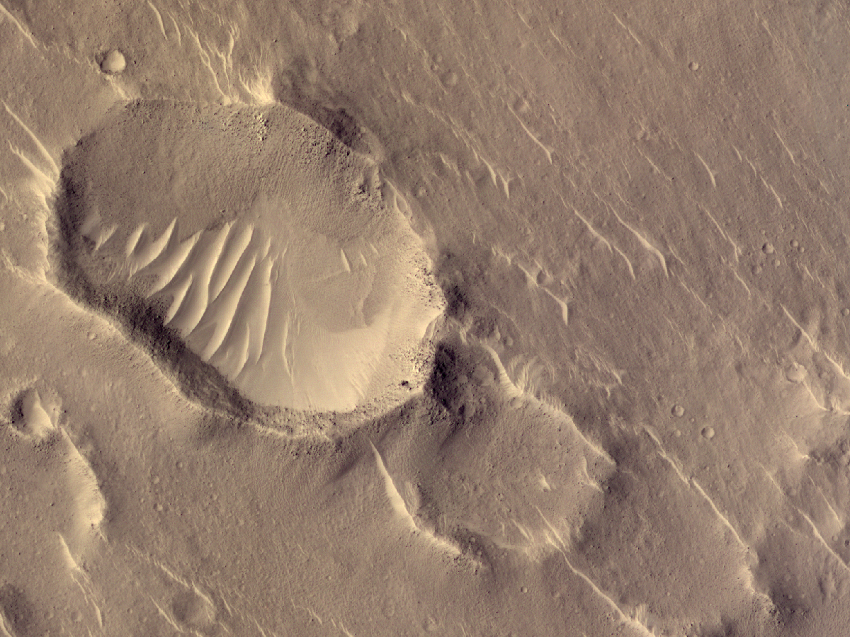
July 22, 2014 A piece of Mars: Using dunes to interpret the winds can be a tricky business. Here’s one reason why: most of the dunes here go from the upper left to lower right. But the ones inside the funky oblong crater go from the upper right to the lower left. Why? One of two reasons. Either the rim of the crater rotates the winds that blow inside, or the rim blocks one wind but lets in another that is less effective at making dunes outside. (HiRISE ESP_036934_1915, NASA/JPL/Univ. of Arizona)


4 Comments
Found your site after searching for MSL KML, lknoiog to plot the location of the various hardware from the lander in the surrounding landscape. Love your application mapping the view in the various raw images from the lander. I wonder if you might accomplish what I was hoping to do: could you map the other hardware in the landscape so it will be obvious when these items might be possibly visible in the images?
I’m sure it could be done, but I don’t have the software for it. Try asking someone on the team – have you seen curiosityrover.com? Look at their Image Synth, it shows data products at each location and where the cameras/instruments were pointing. If someone mapped out the hardware then it might be automatically put into those images, if it ever appeared in them.
Hi Doc…what a weekend here for street observing the evening skies at sunset and moonrise in the Northeast. 7/11 – 7/13 brought us “Manhattanhenge” and the Super-moon both thrilling us all with celestial precisions and beauty. I know it’s not beloved dunes but it was really,really neat viewing here in NYC.
William
It’s love of the night sky that got me to martian dunes in the end, so I understand. Wow, I’d never heard of Manhattanhenge. There are a couple of nice timelapse movies on Youtube. Very cool!